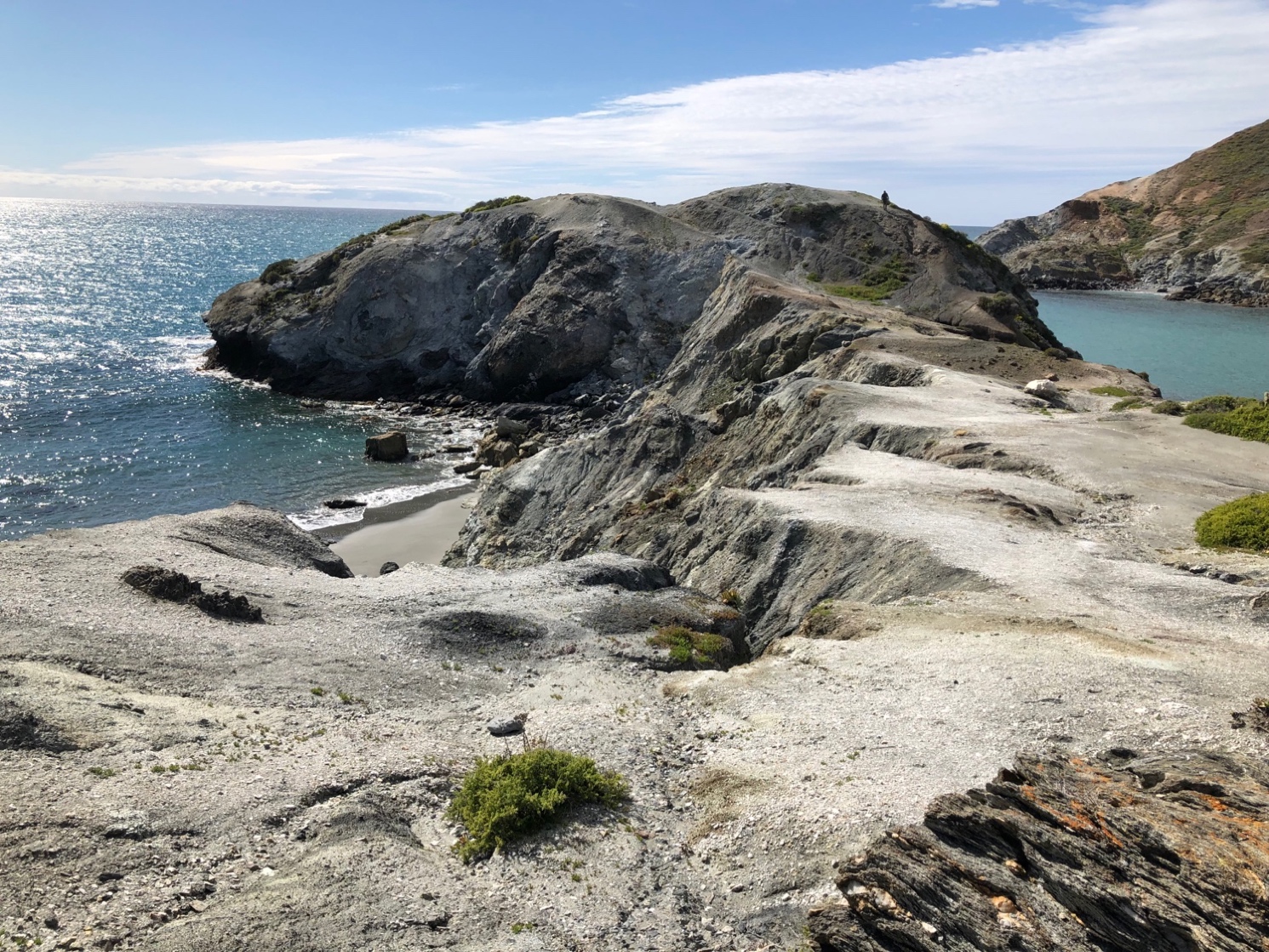
Stop 6
Little and Shark
Harbors Area
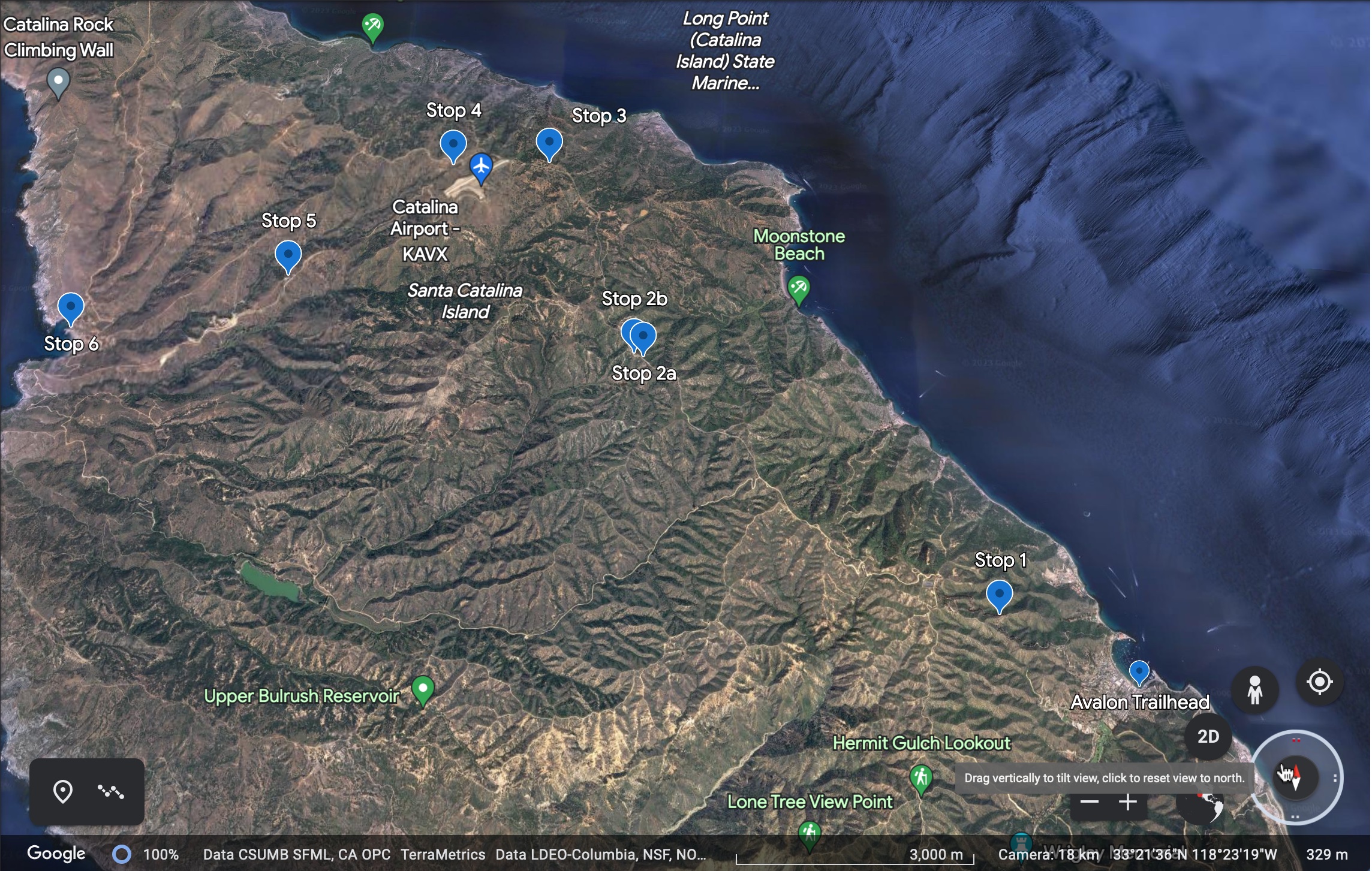
Stop 6 is southwest from Stop
5. (Google Earth)
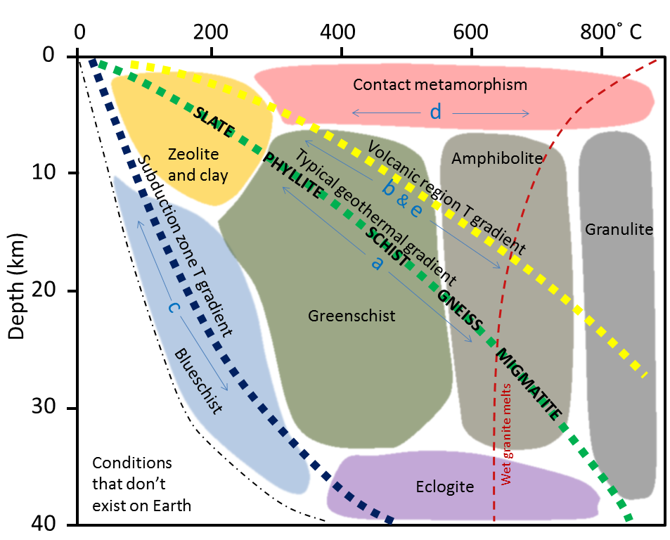
Temperature and
depth of burial for blueschist facies.
Stop
6
The
metamorphics on the island are generally soft and
easily eroded, so if you want to see the many nuances found in the rocks you
must look where the large streams dump into the ocean. At this stop, most but
not all of the material has been brought in by streams
and/or slumping. There are better places to see this on the island, but Twin
Harbors is easily accessible for larger group trips. Probably the best area to
see this is just southeast of Empire Landing in Rippers Cove. Access to Rippers
Cove by land is difficult unless you know exactly how to get there, by sea you
can anchor in the cove and go onshore. The beach literally sparkles there from
the different varieties of metamorphic rocks found there. The classic Catalina
Island metamorphic sequences I use in the classroom mostly came from Rippers
Cove.
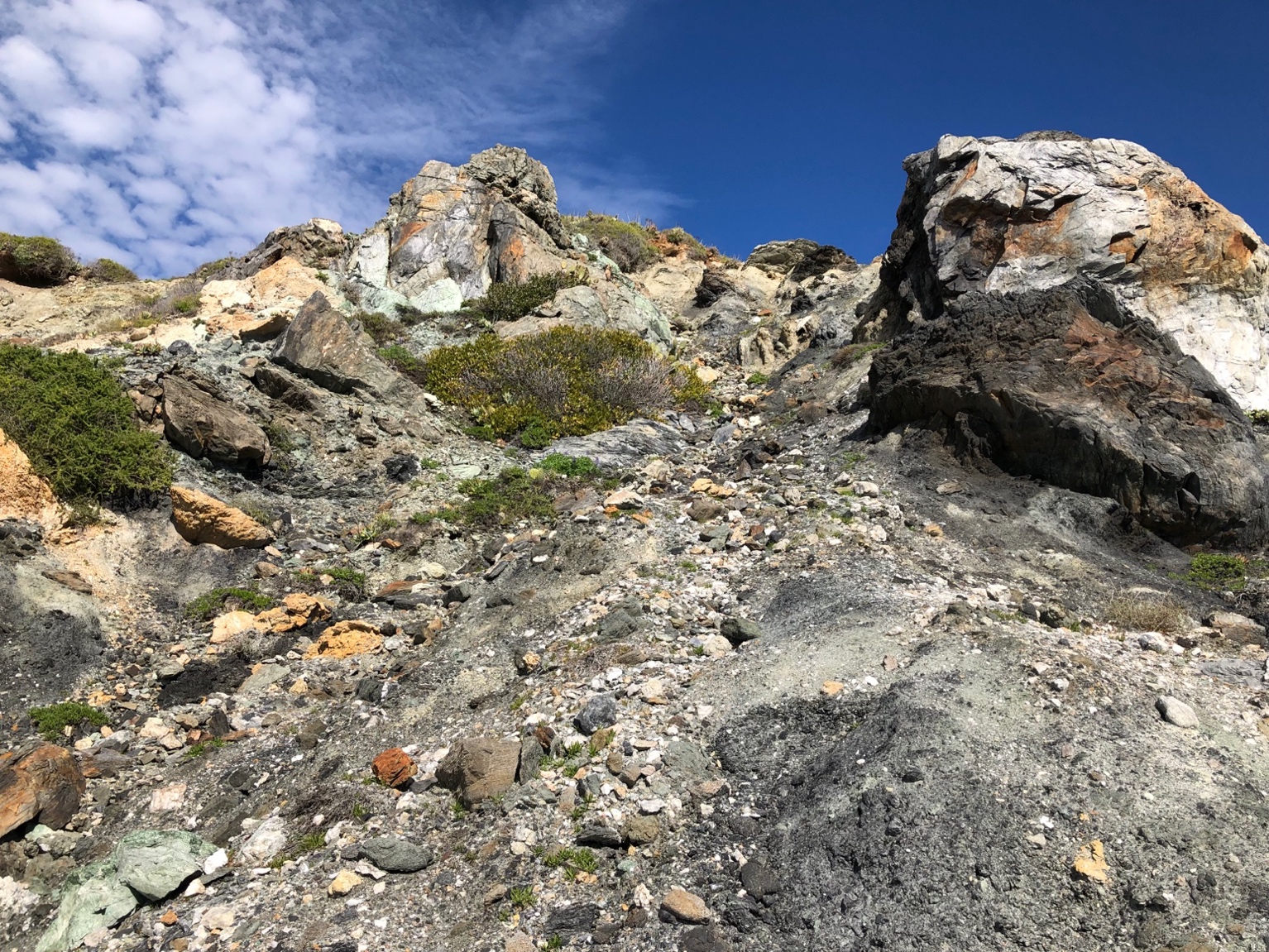
These are
pictures of the rubble found in Twin Harbors area. The material found here
traveled from high up on the island and down the streams to get here. Theres lots to see here and it’s fun to speculate exactly
what you are looking at, we usually spend about an hour here, if the waters
warm it’s a nice place to knock the dust off you and swim. It’s common to see
sea lions with large shark bites here and a bit disconcerting if it’s after a
swim!
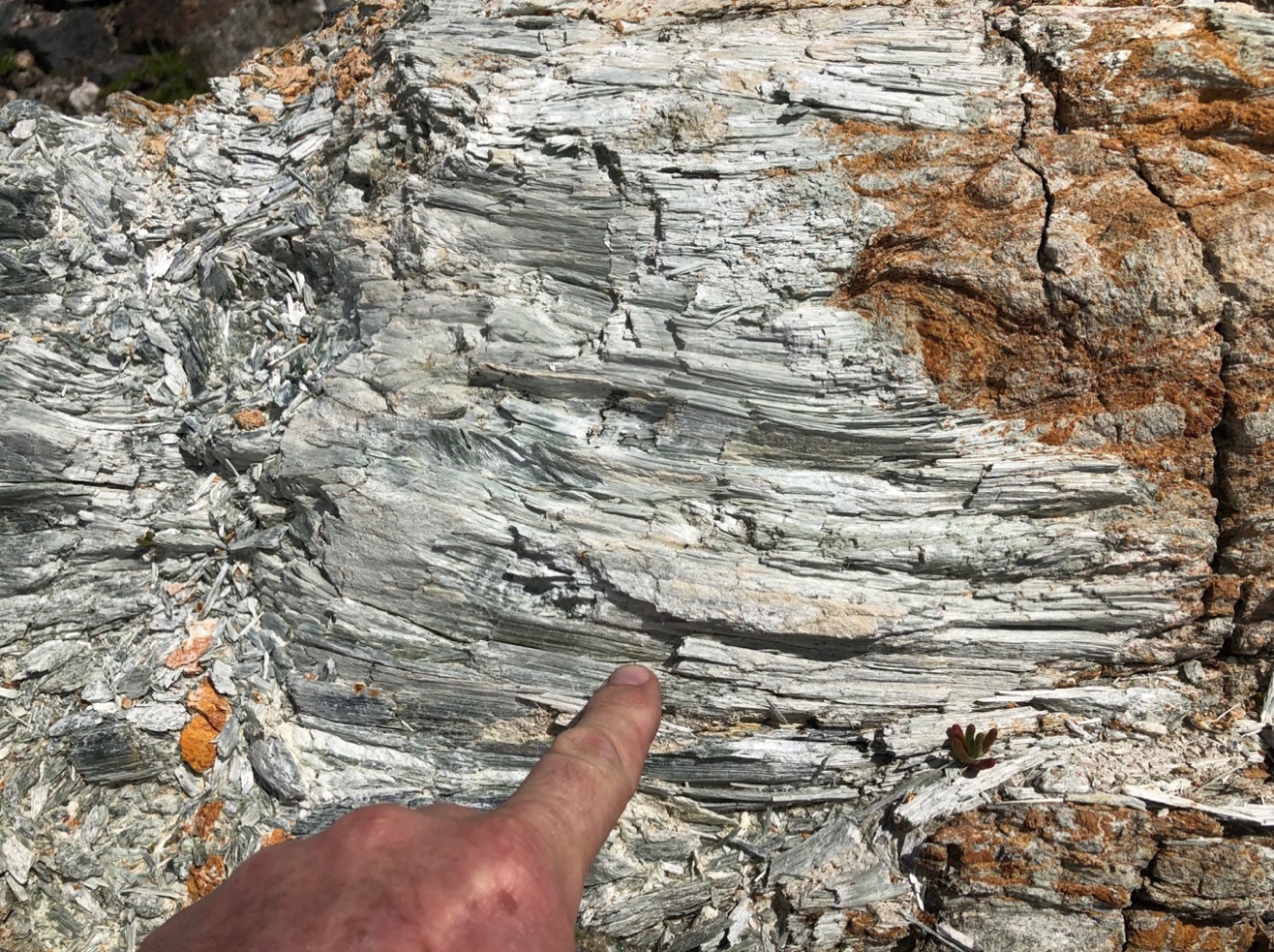
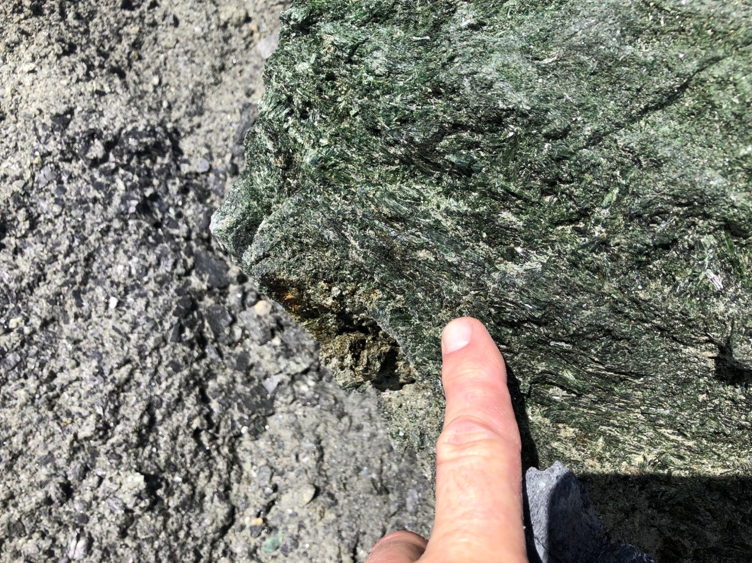
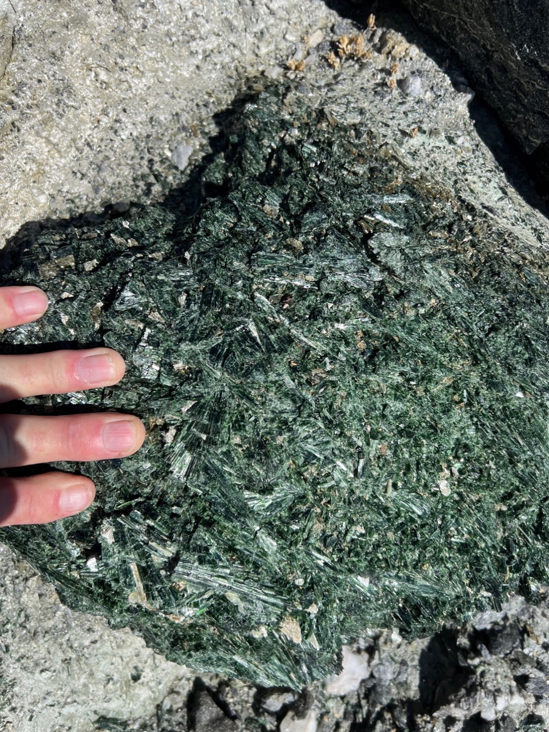
Little Harbor Photo 1 weathered actinolite/tremolite
series. Photo 2 talc
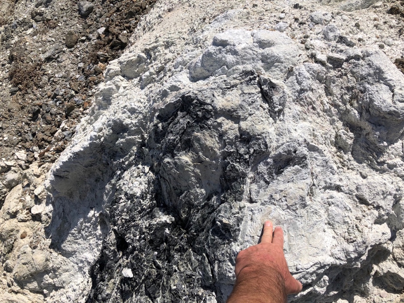
The blueschist whale tail and greenschist in the lower
right, much of this is out of place. The rubble hill is right behind the whale
tail has a lot of interesting rocks on it. These were transported down the
streams forming a talus slope of mixed rocks.
Two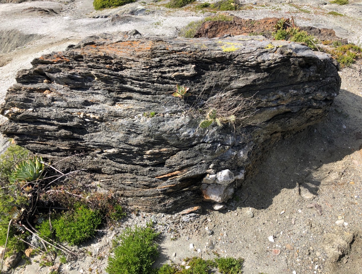
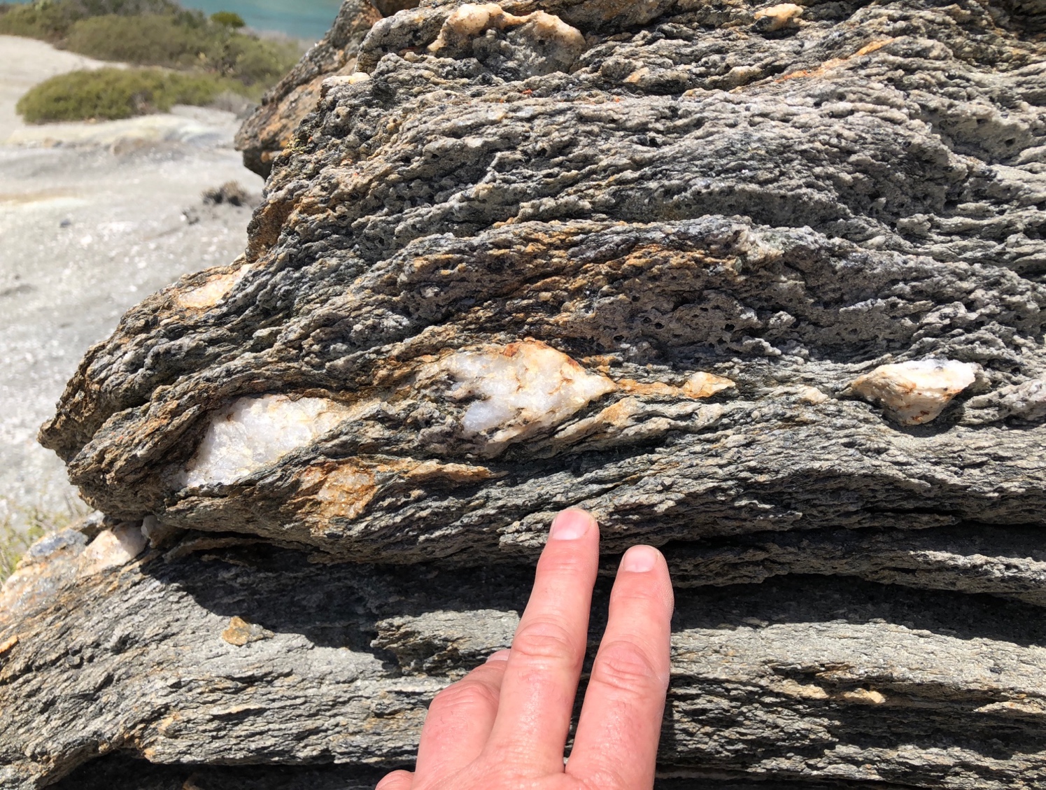
Greenschist with quartzite
Greenstone with epidote/actinolite. Epidote is a key
marker mineral for the greenschist facies.
in the Two Harbors area