| Common links by type of Award | ||||||
|---|---|---|---|---|---|---|
| HOME | Alphabetical | By Council | By Category | By Area | Misc. Links | Gen Requirements |
The trails in this award are easy to moderate in the mountains surrounding Prescott, AZ.
Elevations range between 5,000' to 7,600'. The routes make use of old roads, trails
and powerlines in various combinations.
For the Bradshaw, Maverick Ridge, Sierra Prieta, and Granite Mountain hikes contact:
District Ranger, Bradshaw Ranger District, RFD 7, Box 345 1, Prescott, AZ. 86301.
BRADSHAW TRAILS / FIVE SEGMENT AWARDS:
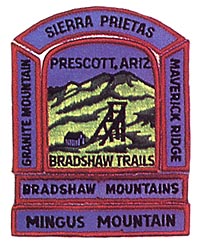
BRADSHAW MOUNTAINS
Requirements:
1. Start three miles west of Palace Station on the Senator Highway,
this route crosses Turkey Creek, passing the War Eagle Mine, on its
way to the Mount Union Lookout, then north to Hassayampa Lake, the
Water Shed Trail, and Government Canyon, into Prescott.
2. Length: Approximately 15 miles.
3. Maps: USGS (Topos) Prescott, Mount Union (I 5 min.)
MAVERICK RIDGE
Requirements:
1. Start at the junction of the Senator Highway and the road to the Davis Dunkirk Mine. It skirts the side of Mt. Tritle, passes Kendall Camp, down Hassayampa Creek, then over the ridge to Lower Wolk Creek Campground.
2. Length: 6 miles
3. Maps: USGS (Topos) Mount Union (15 min.) (I 5 min.)
SIERRA PRIETA
Requirements:
1. Start at the junction of the Senator Highway and the road to the Davis Dunkirk Mine. It skirts the side of Mt. Tritle, passes Kendall Camp, down Hassayampa Creek, then over the ridge to Lower Wolk Creek Campground.
2. Length: 6 miles
3. Maps: USGS (Topos) Mount Union (15 min.)
GRANITE MOUNTAIN
Requirements:
1. Start at Iron Springs and go west of Little Granite Mountain, Alkali Springs, through Blair Pass, and on to the top of Granite Mountain (7,626'). Use the same route to return.
2. Length: 12 miles.
3. Maps: USGS (Topos) Iron Springs (15 min.)
MINGUS MOUNTAIN
Requirements:
1. Start at Sheep Camp, on the old narrow-gauge railroad between
Chino and Jerome, take Forest Trail # 102 to the x,icinitv of Potato Patch Camp,
then take the powerline southeast to Hicky Mountain, turn southwest
down a canyon to Highway 89.
For the Mingus Mountain hike contact:
District Ranger, Verde Ranger District,
Star Route 1,
Box II 00,
Canip Verde, AZ. 86322
2. Length: 8-1/2 miles.
3. Maps: USGS (Topos) Mingus Mountain (15 min.)