| Common links by type of Award | ||||||
|---|---|---|---|---|---|---|
| HOME | Alphabetical | By Council | By Category | By Area | Misc. Links | Gen Requirements |
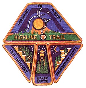
HIGHLINE TRAIL

HIGHLINE TRAIL
For a great hiking adventure, the Highline Trail offers breathtaking scenic beauty,
a wide variety of plant and animal life, spectacular geological formations, and a
fascinating background of Indian and pioneer history.
The name "Highline" comes from its location along the highest contour line along the
base of the majestic Mogollon Rim at which the location of such a trail is practical.
It was built by the Tonto National
Forest Rangers to reach the "hard to get at" locations along the Rim with fire
fighters and equipment for forest protection. Portions of the trail were used
at an even earlier date as routes of communication between the few isolated
ranches in the Tonto Rim country.
The trail begins at the base of Mogollon Rim just south of Pine and winds
its way eastward through heavily forested areas at an average elevation of 5,700
feet for a distance of approximately 50 miles. The trail may be hiked almost year
round. Care must be taken to avoid times of extreme weather conditions (both snow
storms and thunder storms). The trail is divided into three sections: (1) Pine to
Washington Park, (2) Washington Park to Tonto Creek Oust below the State Fish Hatchery).
This is near Zane Grey's cabin where the famous novelist wrote many of his books.
And, (3) Tonto Creek to Highway 260 east of Christopher Creek. It parallels the
early General Crook military road along the top of the rim which is still in use.
The trail goes through Camp Geronimo and crosses Tonto Creek ust below the State
Fish Hatchery.
Requirements:
1. Obtain information about trail and forest conditions and restrictions by
contacting the Payson office of the Forest Service.
2. All supplies and equipment used on the trip must be carried by members of
the group as they hike the trail. No supplies may be carried by cars or other
motorized vehicles.
3. All hikers must begin and end at the designated locations. There will be
no shortcuts allowed.
4. Each hiking group must compile and submit with the award application a journal
describing the trip, including triil conditions, list of animals, plants, geography
and other items of interest observed along the way.
5. Obtain a current copy of "Highline Trail" from the Theodore Roosevelt Council.
This outline contains a complete list of rules, requirements, required equipment,
and list of plants and animals common to the area.
6. Hikers completing any of the sections of the trail will receive the Highline
Trail Patch as well as a segment for each segment of the trail that is hiked.
Groups may start from either end of the trail for any of the segments.
7. Meet and comply with the GENERAL REQUIREMENTS.
SEGMENTS:
BAKER BUTTE
The trail head is marked by a large sign on Highway 87 about one mile south of Pine.
The sign reads "Pine Trailheid". The trail begins south of Pine at the highway and
heads east around Milk Ranch Point through Camp Geroniino to Washington Park. This
section is approximately 18 miles in length. Camp Geronimo may be used for an
overnight campsite with prior arrangement or other sites may be used at Poison
Springs, Sycamore Creek, West Chase Creek, and East Chase Creek. All of these
should have water nearly year round. The trail is shown on the Tonto National
Forest map as Forest Trail #3 1, but for greater detail the "Buckhead Mesa" and
"Kehl Ridge" quadrangle topo maps should be used.
FISH HATCHERY
This section begins at Washington Park and heads along the Rim passing close to
Zane Grev's cabin and ending it Tonto Creek. The trail is approximately 15 miles
in length with numerous campsites at creeks crossing the trail. The more reliable
sources of water may be found at East Verde, Dude Creek, Bonita Creek, Perly Creek,
and at Ellison. The triil iii;in be found on the "Kehl Ridge", "Dane Canyon",
"Promontorv Butte", and "Knoll Lake" quadrangle topo maps. The entire trail may
be found on the forest service map.
PROMONTORY BUTTE
The trail begins at Tonto Creek and goes east winding around Promontory Point
and ends at Highway 260 just before it climbs the Rim. This trail section is
approximately 14 miles in length. Campsites may be found at Dick Williams Creek,
Horton Springs, and See Canyon all of which should have water available.
"Promontory Butte" and "Woods Canyon" topographical maps will show the tcrrain
along the trail. The final -portions are NOT MARKED on the topo maps. However,
the Tonto National Forest will have the needed information.