| Common links by type of Award | ||||||
|---|---|---|---|---|---|---|
| HOME | Alphabetical | By Council | By Category | By Area | Misc. Links | Gen Requirements |
MAZATZAL WILDERNESS TRAILS
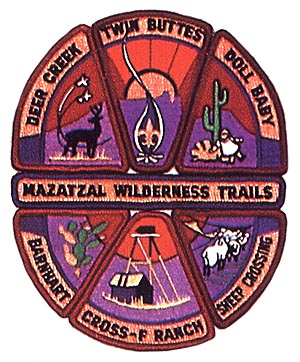
MAZATZAL WILDERNESS TRAILS
Mazatal (pronounced MA-TA-ZEL', although the pronunciation found in Webster's Geographic Dictionary is MA'SATSAL') to the Paiute Indians means empty space between. The Mazatzal Wilderness Area is located in Central Arizona between the Verde River on the west, and the Beeline Highway (State Route 87) on the east. It stretches from south of Strawberry to just north of Sunflower. Parts of the wilderness area arc in each of three counties - Gila, Maricopa and Yavapai. It contains 205,000 acres and is the second largest wilderness area in Arizona.
Elevations range from 7000 ft. in the highest passes to around 2400 ft. along the Verde River. The "Mazatzal Divide" runs approximately north to south close to the eastern boundary of the wilderness area. From the Divide the land slopes west toward the Verde River in a series of rugged mountains and twisted canyons.
Weather and vegetation vary greatly in the Mazatzals. Temperatures can reach an extreme low of -15 degrees F and highs of 115 degrees F. Vegetation ranges from Pondorosa Pines and Douglas Fir through Pinyon Pine, Oak, Juniper and Arizona Cyprcss to Mesquite Catclaw, Saguaros, ctc. Dangerous winter storms and blistering summer heat (with accompanying lack of water) can be problems in the area. Nevertheless, the Mazatzals can provide a truly meaningful wilderness experience to those who come prepared.
The area is administered by four ranger districts of the Tonto National Forest. For more information see the Tonto National Forest Map and the Mazatzal wilderness Map both distributed by the forest service.
Tonto National Forest
2324 E. McDowell Rd.
Phoenix, AZ.
Requirements:
1. You must be a registered Boy Scout or Scouter.
2. All hikes must be supervised by a minimum of two adults (at least one must be over 21) with at least two adults for each 12 boys.
3. Awards will be denied for misconduct.
4. All of these trails are within the Coronado National Forest. Contact the appropriate office well in advance of your trip for information and details on hiking and/or camping on your trek.
United States Forest Service (602) 629-6483
Coronado National Forest
300 West Congress
Tucson, AZ. 85701
5. Hikes must be completed. Weather, trail closure, tired boys or leaders who cannot go on, equipment failure, etc., may make it wise to stop short of completing these hikes, but do not justify granting the awards.
6. Individual "Trail Logs" describing what you did and what you saw must be signed by the Trek Leader and submitted with your High Adventure application.
7. Only one Patch or Medal will be issued to each participant.
8. Wearing Awards. Trail award patches may be displayed on the jacket, pack, camping gear or worn as a temporary insignia on the right shirt pocket. Medals may be worn on the left breast pocket to the left of the Eagle Badge on the Scout Uniform. Use Cub Scout Den numerals on trail medals as "repeater" numbers for those earning trail medals more than once.
SEGMENTS:
BARNHART
Beginning a hike at the Barnhart trailhead, visit one or more of these areas: Chilson's Spring, Brody Seep, Malapais Spring, Windsor Spring or Hopi Spring. The trails in this segment are best suited for hiking in the Spring or Fall. Details for the entire Barnhart segment area are found on the Mazatzal Peak Quadrangle Map.
DEER CREEK
Beginning at the Deer Creek trailhead, hike one or more of these trails in their entirety: #45, #46, or #47. You must also visit either Gowan Camp or Maple Springs on the hike. This area offers good weather possibilities from September through June. Details for the entire Deer Creek segment area (except for the Deer Creek trailhead itself by 1/8 mile) are found on the Mazatzal Peak Quadrangle Map.
DOLLBABY
Beginning a hike either at the Doll Baby or the City Creek trailhead visit at least one of these areas: (a) The Park (Pctc's Pond Area), (b) Fuller Seep, (c) Bnish Spring. The higher elevation options are best in October, November, April or Mav. The lower elevation options are best in October through April. See both the North Peak and Cypress Buttes Quadrangle Maps.
CROSS F RANCH
Do all of the following: (a) Hike all of trail #244 from Cross F trailhead, (b) Hike trail #88 between its junctions with #244 and #87, and (c) Visit Potato Patch. These hikes are best suited for October through May. For details for the arca's segment see the Lion Mountain Quadrangle Map and the Reno Pass Quadrangle Maps.
TWIN BUTTES
Beginning a hike at Twin Buttes trailhcad, hike to the East Verde River. This hike is best suited for Spring or Fall. See the Cane Spring Mountain Quadrangle plus the Verde Hot Spring Quadrangle (west option) plus the Cypress Quadrangle (cast option).
SHEEP CROSSING
This hike segment was scheduled for program inclusion in Autumn of 1987. As of this printing we do not have additional details. Please check with the Theodore Roosevelt Council Camp Office.
You must OBTAIN A CURRENT COPY of Catalina Council's "Where To Go Camping in Arizona & the Southwest", trails edition. This brochure contains trail information, history, suggestions and other helpful aids. The following General Requirements apply.