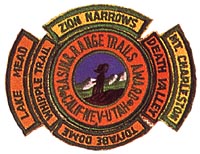
| Common links by type of Award | ||||||
|---|---|---|---|---|---|---|
| HOME | Alphabetical | By Council | By Category | By Area | Misc. Links | Gen Requirements |
Any of the following Mt. Charleston trails may be taken to qualify for the MT. CHARLESTON SEGMENT.
MT. CHARLESTON
MT. CHARLESTON NORTH LOOP TRAIL
Requirements:
1. LENGTH: 18 miles.
2. LOCATION: In the Spring Mountains 35 miles northwest of Las Vegas, Nevada
3. DIFFICULTY: Strenuous either for a one-day round-trip or if backpacking for an overnight.
Altitudes range from 7,700' to almost 12,000'.
4. DESCRIPTION: From the trailhead to 1-1/2 miles is ajeep trail that rises
slightly to a burnt out canyon (1977). 1-1/2 to 3-1/2 miles is a steep switchback
climb to a trail junction in a saddle on a spur ridge. Take Mt. Charleston Trail
to the left which climbs at an easy rate along the west flank of Mummy Mountain.
Another series of switchbacks will bring you to the divide between Kyle and Lee Canyons.
The last mile
of the trail is a series of switchbacks up a talus slope to the summit.
5. CAMPING & WATER: Except for snow the only water is at a spring 4-1/2 miles up the trail.
This is also a good campsite that will provide shelter for four people.
Another good campsite lies on the divide between Kyle and Lee Canyons
in a Bristlecone forest about 5 to 5-1/2 miles up the trail.
6. MAPS: Charleston Peak, Mountain Springs (USGS 15 min.),
Toiyabe National Forest (Forest Service)
MT. CHARLESTON SOUTH LOOP TRAIL
Requirements:
1. LENGTH: 18 miles
2. LOCATION: In the Spring Mountains 35 miles northwest of Las Vegas, Nevada
3. DIFFICULTY: Strenuous either for a one-day round-trip or if backpacking for
an overnight. Altitudes range from 8,000' to almost 12,000'.
However, the trail is well graded.
4. DESCRIPTION: The first 3-1/2 miles is up through a forested area with many
switchbacks to the ridge crest. The trail then follows the ridge to the base of
the peak, The last mile is a
steady climb above the timberline up a talus slope to the summit.
5. CAMPING & WATER: There is a spring near the last switchback before reaching
the ridge. Also, Peak Spring is located 1/2 mile down Peak Spring Canyon from
where the trail makes the final ascent to the peak. The Forest Service map shows
these springs.
The best camping is where the trail meets the ridge.
6. MAPS: Charleston Peak, Mountain Springs (USGS 15 min.),
Toiyabe National Forest (Forest Service)
CAMP BONANZA to LEE CANYON TRAIL
Requirements:
1. LOCATION: Spring Mountains 40 miles northwest of Las Vegas, Nevada
2. LENGTH: Estimated 20 miles.
3. DIFFICULTY: No member of the High Adventure Team has hiked this entire
trail all the way, so we offer very little, information.
4. DESCRIPTION: Six miles of the Camp Bonanza end of the trail is described on the EAGLE EYE - BONANZA PEAK
TRAIL information sheet in "Basin Range Trail Hiking Program"
5. MAPS: Charleston Peak, Mt. Sterling (USGS 15 min.)