| Common links by type of Award | ||||||
|---|---|---|---|---|---|---|
| HOME | Alphabetical | By Council | By Category | By Area | Misc. Links | Gen Requirements |
These hikes are in the vicinity of the San Francisco Peaks, the surrounding plateau and its rugged canyons in northern Arizona. Write to: Trails Committee, c/o Grand Canyon Council, for current trails and road directions and field notes. Write to appropriate office of U.S. Forest Service for fire closures, trail and road conditions and other current data before attempting these treks.
SAN FRANCISCO PEAKS TRAILS
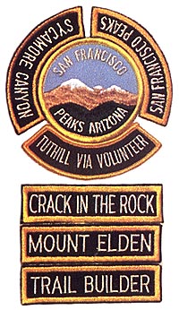
SAN FRANCISCO PEAKS
Requirements:
1. This hike offers a choice of nine routes, over and around peaks; you make up your own hike, choosing any three or more routes put together, with the aid of a prepared map and route directions, available from the Council Office. Routes are not marked on the ground; they go cross-country and challenge you to use map, compass, and altimeter to make your way over and around the mountains.
2. Elevations: 8,000' to 12,000'.
SYCAMORE CANYON
Requirements:
1. This hike through rugged Sycamore Canyon is a two or three-day trip which is best traveled downstream, starting at either the Boy Scout Reservation or at Winter Cabin near Turkey Butte and ending at the Verde River. Length: 44 miles. This is one of the most demanding hikes in the Council's awards program.
2. Maps: USGS (Topos) Sycamore Point, Sycamore Basin, Loy Butte (7.5 min.). For information and maps write the District Ranger, Flagstaff District, U.S. Forest Service, 1100 N. Beaver St., Flagstaff, AZ. 86001.
TUTHILL VIA VOLUNTEER
Requirements:
1. Follow the powerlines between Ft. Tuthill (County Fair Grounds) and the Boy Scout Reservation. Hike courses across typical Coconino plateau terrain of ponderosa pine forests atop volcanic rock formations.
2. Difficulty: Easy Length: 18 miles. Maps: USGS (Topos) Flagstaff West, Bellemont, Garland Prairie (7.5 min.)
CRACK-IN-THE-ROCK
Requirements:
1. Hike to one of the major Indian Ruins in Wupatki National Monument. Specific permission must be obtained in advance. Write to: Superintendent, Wupatki Monument, Tuba Star Route, Flagstaff, AZ. 96001.
2. Difficulty: Easy, except in hot weather. Length: A guided 18-mile round trip. Maps: USGS (Topos) Wupatki Southeast, and Wupatki Northeast (7.5 min.)
MOUNT ELDEN
Requirements:
Complete ten non-repeating miles in the new Mount Elden - Dry Lake Hills Trails system near Flagstaff. Information is available from the Scout office or the Forest Service (Elden district).
TRAIL BUILDER
Requirements:
Perform 16 hours of trail building or maintenance on any of the areas covered by the San Francisco Peaks Trails (San Francisco Peaks, Sycamore Canyon, Tuthill Via Volunteer, Crack-In-The-Rock, or Mount Elden). Prior approval of the Trails Committee and appropriate Forest Service District Office or National Park Service is necessary.