| Common links by type of Award | ||||||
|---|---|---|---|---|---|---|
| HOME | Alphabetical | By Council | By Category | By Area | Misc. Links | Gen Requirements |
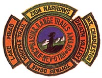
Arc Dome and Toiyabe Dome Southeast Summit arc two of the highest peaks in the Toiyabc Range and arc located 50 miles north of Tonopah, Nevada. Hikes to either of these two peaks would earn the TOIYABE DOME SEGMENT. The three most popular trailheads are described below. Use Tonopah USGS Topo Map and Toiyabc National Forest, Central Nevada Division (shows trails).
TOIYABE DOME
SCHWAUB PEAK HIKE
Requirements:
1. LOCATION 207 miles north of Las Vegas, Nevada to Tonopah, Nevada From Tonopah,
drive 5 miles cast on Highway 6, then north on highway 8A. Drive 35 miles to
turnoff to Peavinc Canyon. A sign here says "Peavine Campground 9 miles".
Drive 14 miles up this graded dirt road following Peavine Canyon to the Tom's
Canyon turnoff. Drive up Tom's Canvon about 1/2 mile and start hike from that point.
The road is closed to vehicles 0.9 miles up Tom's Canyon.
2. CAMPING AND WATER Good stream of water and excellent camping with plenty
of wood along this portion of Tom's Canvon.
Elevation here is 7, 1 00'.
JETT CREEK
Requirements:
1. LOCATION 207 miles north of Las Vegas, Nevada to Tonopah, Nevada From Tonopah,
drive 5 miles cast on Highway 6, then north on highway 8A. Drive 48 miles to Jett
Canyon turnoff. Follow this graded dirt road east for 5 miles to the mouth of Jett
Canyon. The road up the canyon is closed from March I st to May 3 1 st. When the
road is open you can get a truck up
the canyon another 2 miles (4 miles with a good 4-wheel vehicle).
2. CAMPING AND WATER Good campsites along the first five miles of Jett Creek.
The stream crosses the road 17 times in this first five miles. The trail beyond the
road is little used and has not
been cleared of brush and fallen trees for several years.
3. Maps: Pablo Canyon Ranch (USGS 7-1/2 min.) for first 3 miles of Jett Canyon.
TWIN RIVER
Requirements:
1. LOCATION 207 miles north of Las Vegas, Nevada to Tonopah, Nevada From Tonopah,
drive 5 miles east on Highway 6, then north on highway 8A. Drive 61 miles to the
South Twin River turnoff. Turn west and drive 4 miles on a dirt road to the mouth
of Twin River Canyon. The first mile of trail up South Twin Canyon does not follow
the river. The trail climbs up the Mountainside to the south. The river, road, and
trail are shown in detail on the map. The detail shows only the first mile of the
South River and none of the North River. The North River Trail is the most used.
Good trout fishing on either river. Look for Desert Big Horn Sheep
2. MAPS: Carvers NW (USGS 7-1/2 min.)