Geology
Regional Geology
Current
Structural Setting
The current structural setting has the San Andreas Fault between the Pacific (San Diego) and North American (San Francisco) Plates (Figure 1a). There are currently no subduction zones located in offshore Southern California as there were in the past and discussed below. There is a divergent plate boundary to the south in the Gulf of Mexico. A transform plate boundary (The San Andreas Fault) extends over much of the State of California. Farther north, there is a convergent plate boundary with subduction off the coast and andesite volcanoes inland.
Past Structural Setting
The features found on Catalina
Island were formed in very different structural setting (Figures 1b and 1c).
Extensive subduction occurred on the western edge of North America from
Early Mesozoic to Early Miocene time (approximately 200 to 20 million years ago
MYA) (Figures 1d, 1e, and 1f). A transition from subduction (and plate
convergence) to primarily a transform boundary occurred during Miocene time
(from approximately 20 to 5 MYA). This transform boundary eventually became the
San Andreas Fault (Atwater 1998). The metamorphic rocks on Catalina are a
product of regional metamorphism related to a convergent plate boundary
subduction zone.
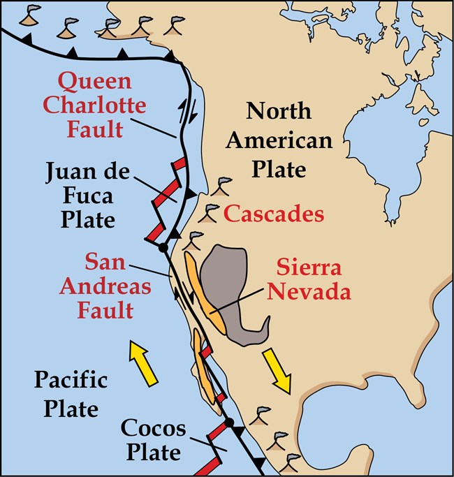
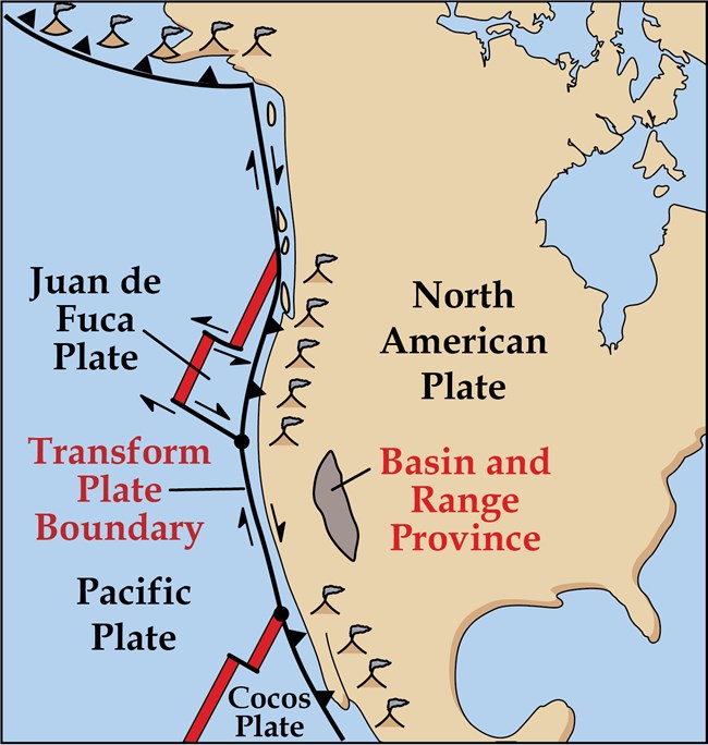
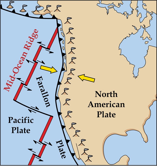
Figure 1a: The current plate tectonic setting of the West
Coast of North America. The current San Andreas transform fault.
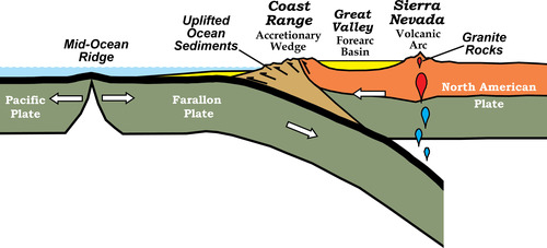
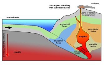
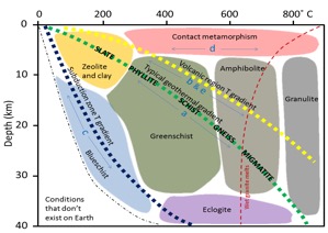
Figure 1d This is the process of subduction
as it relates to a convergent plate boundary.
Figures 1e and 1f This shows how the subduction
process is related to regional metamorphism and the difference between a
continental gradient and a subduction geothermal gradient.
The uplift of the island is related to two different systems. The west coast of the United States is an emerging coast, meaning that the uplift is regional, slow and relatively steady. The second cause of the uplift is from transpressional right lateral sympathetic faulting related to the San Andreas fault system. The Catalina fault is a right lateral that runs adjacent to the island on the west side and turning to the left in front of the island, this causes compression and on right lateral faults it causes compression and uplift (Figures 1h and 1i. A similar system uplifts the Mt Soledad area in La Jolla, to give you an example the uplift from the emerging coast is about 5 inches per thousand years and from the compression on the Rose Canyon fault and another 7 inches per thousand years, giving a total of about 12 inches per 1000 years.
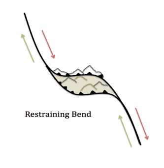
Figures 1h and 1i The first figure shows Catalina right lateral slip fault turning to the left in front of the island. Figure 1i shows a right lateral fault turning to the left. This causes compression and uplift. This mechanism is common in Southern California uplifting the San Bernadino mountains, San Gabriel mountains, and Mt Soledad in La jolla.
Local Geology
This is geologic map of the island
for a more
detailed PDF file click here.. The southeast side of the island are Miocene
Igneous rocks (in light blue and pink). The majority of
the island to the northwest are Cretaceous metamorphic rocks (yellow, green,
gray green. These units are described in more detail below.
A note about
metamorphic rocks
Metamorphic means “changed form” so as you change metamorphic facies you find
different minerals. The suite of minerals define each
facies, so if you identify the minerals in a metamorphic rock, you can
determine the pressure and temperature that the rock formed in, and in turn the
facies it belongs to (Figures 1e and 1f).
The protolith is original starting material that has been metamorphosed. For this example on the island we are looking at regional metamorphism related to a subduction zone. In a subduction zone there are many different materials that go down the trench, from deep sea sediments, turbidites, basalts, even ultramafics etc, so here we see a wide variety of minerals comprising each facies. In contrast, rocks that form from a single mineral protolith have little variability. For example, if you metamorphose a sandstone you get a quartzite, or a limestone you get a marble.
On this fieldtrip, we will observe three rock units ranging from Cretaceous to Miocene in age. Each rock formation/unit is described below in order of decreasing metamorphism and age.
Cretaceous Metamorphic
Facies/Catalina Schist
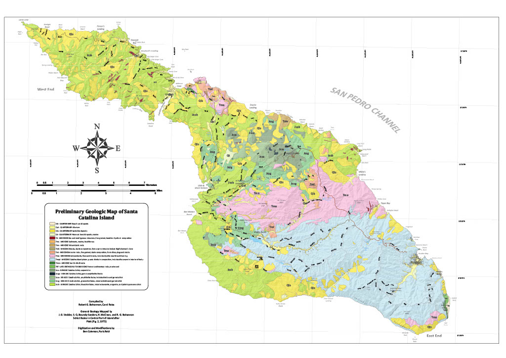
Garnet Amphibolite
The index minerals for this facies
are hornblende, garnet, and actinolite, are generally formed with a mafic
protolith. They can also contain serpentine, talc and tremolite if ultramafic
rocks like peridotite are in the protolith.
On the island it formed at depths up to 35-40 km+/- and temperatures
about 600°C and is approximately 122 +/-3 MYO. The garnet crystals are the
small red pieces in the very dark amphibolite matrix. Amphiboles form on the continental/typical
geothermal gradient (Grove M, Bebout
G.E. 2008)
As stated above, serpentinite can be associated with amphibolite, it’s fairly soft and can contain asbestos minerals, so it’s best not to handle it. Serpentinite is formed from rehydrating ultramafic rocks when brought up from depth. It’s also the state rock of California.
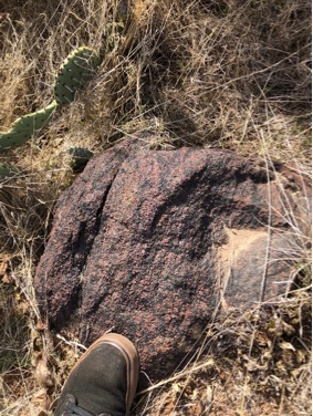
Garnet amphibolite
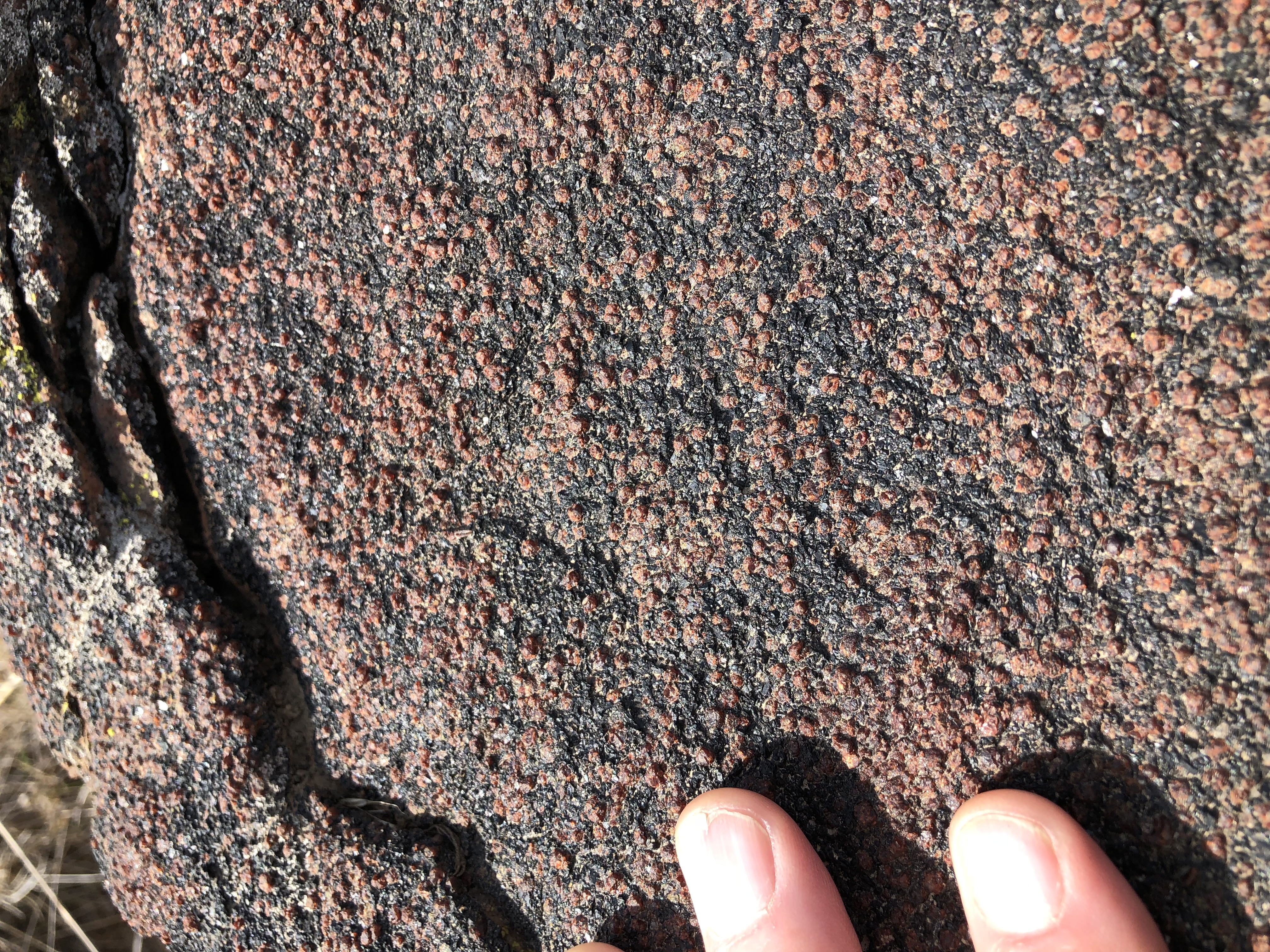
Greenschist Facies
The index minerals which define the greenschist facies are epidote, chlorite and actinolite, they are responsible for the green color that gives the facies its name. The protolith for this facies are mafic rocks such as basalts. Greenschists develop schistosity due to alignment of chlorite and actinolite crystals. If schistosity doesn’t develop because a slightly different mineralogy, it’s called a greenstone. They can also contain serpentine, talc and tremolite if ultramafic rocks like peridotite are in the protolith. The green schist facies has a broad range of temperatures and burial depths as seen on (Figure 1f), but on the island, depths are 20 to 30 km +/- and temperatures around 400°C (Grove M, Bebout G.E. 2008)
This facies has commonly been
broken into two other names, the epidote amphibolite, and the epidote
blueschist. These are lumped together here for simplicity. Greenschist forms on
the continental/typical geothermal gradient.
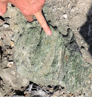
Greenschist and
greenstone samples
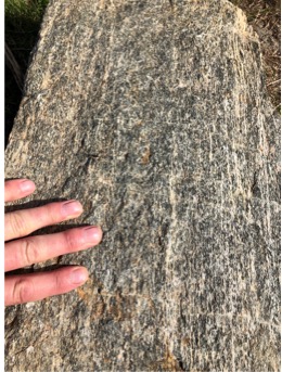
Blueschist Facies
The index minerals which define the blues schist facies are glaucophane and commonly lawsonite, they are responsible for the blue color that gives the facies its name. Blueschists develop schistosity due to alignment of the minerals present. The protolith for these rocks can be highly variable basically anything that’s on the seafloor like turbidites, planktonic oozes and also the ophiolite suites that make up the oceanic crust. The blueschist facies is low temperature but high pressure, this is because they form in subduction zones. The facies is approximately 97 +/- 3 MYO on the island (Figure 1f). Blueschist forms on the subduction geothermal gradient. (Grove M, Bebout G.E. 2008)
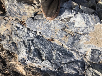
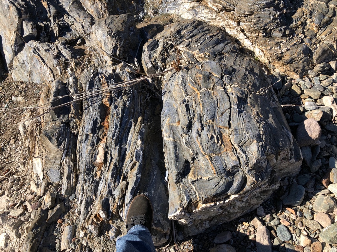
Blueschist facies
rocks
Miocene Igneous Rocks
The Miocene rocks were formed at a time when crustal thinning allowed igneous rocks to be shallowly emplaced (hypabyssal) or extruded to the surface as volcanics. (Crouch J K., Suppe, J, 1993)
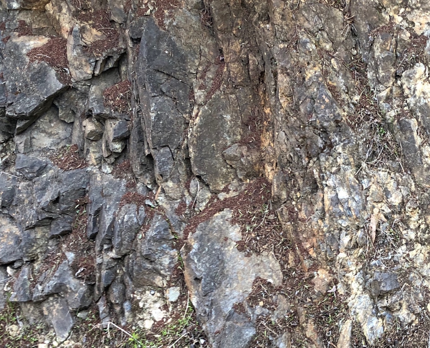
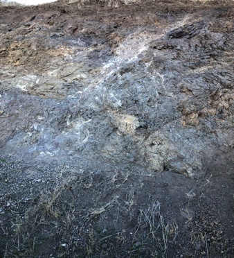
Photo 1 is of the
hypabyssal quartz diorite unit. Photo 2 is of the volcanic unit.